
So, a fantasy world (Or, in our case, a vast continent) needs maps. I decided quite early that I wanted to ask Mark Smylie, who has already worked with us on „The Straight Way Lost“ if he would be up for mapmaking again, and I am very happy to say that he agreed. We have been working on the map during the past few months whenever we had time, and now it is almost finished. Ta-Da!
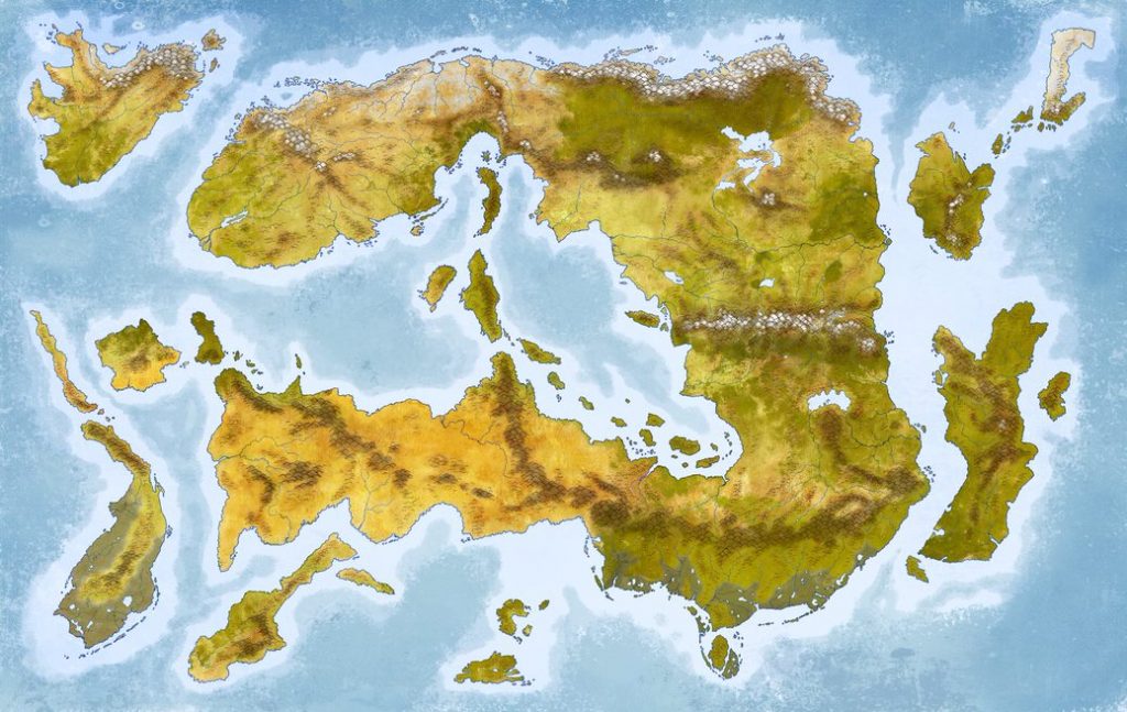
This is the version without any words on it. We have another one, where we have addes names for a lot of the stuff that you can see, plus some cities and special places. At the moment I am compiling a list of things that are still missing, which is quite a lot of work, as I have to go through loads of files. Basically the whole mess I have created since 2016. It’s very interesting that I now have to commit to the stuff I have carelessly named over the years, if a name for a city or mountain range is absolutely terrible, now is my last chance to change it. It feels, well, dangerous.
So, what can you see in the above picture? Well, it’s the continent of Shanarel, which means something like „New Home“ in the elvish language of the world. You have to think so much about names, it sometimes drives you crazy. Most of the time I don’t know what these made-up words mean, I am no Tolkien, and my interest in languages isn’t that great. But it’s also not nothing, so I try not to make a completely terrible job and stay somewhat consistent with stuff. It is quite interesting to think about where names that then stuck for things came from. Most people in Shanarel will, for example, call the oceans by their Malar (Grey Elves) names. They were the foremost seafaring people, and so their language became quite important, even though they never had one of the dominant cultures.
If you think about size, this continent is big, a bit like Eurasia. But then it has this strange shape, which makes travel by boat so much more important.
After Mark and I are finished with this, we will do the political map. Which means that I will draw lots of ugly shapes on a pencil version of this map, give these shape names, and then Mark has to make proper countries with convincing looking borders out of them. The poor, poor man. He is so nice to work with, you should all hire him, by the way.
Also, the first sketches for the illustrations are coming in? Do you want to see sketches? Do you want to read stuff in german? I have written so much, the book will be a little bit long, I’m afraid. Is anybody actually reading this? Please answer if you do, and if you want to see sketches.
Have an excellent day!
Benjamin